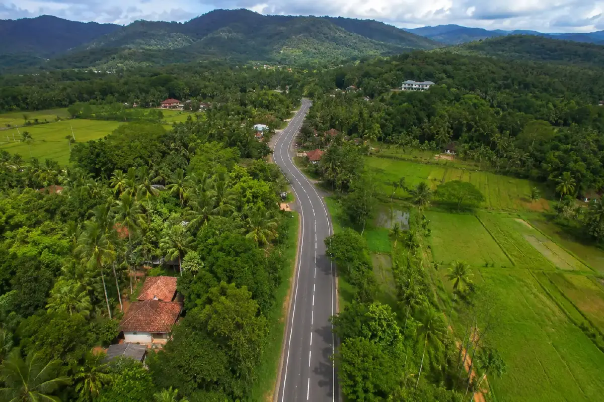
Sri Lanka’s road network plays a critical role in connecting communities, supporting agriculture, improving access to essential services, and strengthening the country’s broader economy. For many rural and provincial areas, roads are more than transportation corridors. They are the links that connect farmers to markets, residents to schools and hospitals, and communities to emergency services.
Through the Inclusive Connectivity and Development Project, known as ICDP, Sri Lanka is working to improve this critical infrastructure across much of the country. The World Bank-funded initiative focuses on rehabilitating more than 1,000 kilometres of provincial and rural roads, with an emphasis on safer transport connectivity, climate resilience, agricultural supply chain improvements, and emergency preparedness.
TotalPave’s smartphone-based IRI data collection system supported this effort by helping make large-scale road condition assessment more practical, accessible, and cost-effective.
Why IRI Data Matters for ICDP
International Roughness Index, or IRI, is one of the most widely used measures for understanding road ride quality and surface roughness. For a project like ICDP, IRI data is especially important because it supports the economic analysis used to determine which roads are most viable for rehabilitation under World Bank procurement guidelines.
In simple terms, IRI helps quantify how rough a road is. That information can then be used to estimate road-user costs, evaluate the benefits of rehabilitation, and compare candidate roads in a structured and defensible way.
For ICDP, this meant IRI data was not just a technical measurement. It was a key input into project planning, prioritization, and decision-making.
The Challenge of Rural Road Data Collection
Collecting road condition data across remote and rural areas presents real logistical challenges.
Traditional road assessment equipment can be expensive, difficult to mobilize, and less practical for large-scale rural networks. In many areas, teams also need to deal with variable terrain, lower-volume roads, limited existing mapping, and long travel distances between sites.
For a project covering more than 1,000 kilometres of roads across most of Sri Lanka’s provinces, the data collection method needed to be flexible, efficient, and scalable.
That is where TotalPave provided value.
A Practical Smartphone-Based Approach
TotalPave’s IRI system allows road roughness data to be collected using a smartphone, a vehicle, and a windshield mount. Instead of relying on specialized survey vehicles or expensive traditional equipment, local teams were able to collect IRI data using a simple field setup.
This helped reduce the barriers to large-scale data collection. Teams could drive the selected roads, collect roughness data, and use the TotalPave platform to support mapping and review.
The system was particularly useful in rural areas where roads may be less formally documented or harder to assess using conventional methods. TotalPave helped teams collect usable IRI data while also supporting the mapping of lesser-known roads that were important to the project.
Supporting Field Teams in Real Conditions
Road data collection is rarely perfect in the field. Routes can be remote, terrain can vary significantly, and local conditions can change quickly.
TotalPave’s platform helped address these practical challenges by giving teams a more adaptable way to collect and review road condition information. The smartphone-based system provided immediate feedback in the field, helping users understand whether data was being collected properly and allowing issues to be identified sooner.
This kind of feedback is especially valuable when working in remote areas. If a data issue is discovered only after a team has left the field, returning to recollect that road can be costly and time-consuming. The flexibility of the TotalPave platform helped mitigate these risks.
Making Road Assessment More Accessible
One of the most important parts of TotalPave’s role in ICDP was accessibility.
Infrastructure planning often depends on data, but collecting that data can be expensive and complicated. This is especially true for rural road networks, where the cost of traditional condition assessment can be difficult to justify relative to the size and location of the roads being evaluated.
By using a smartphone-based approach, TotalPave helped make IRI collection more accessible to local teams. The system provided a practical way to collect road roughness data without requiring specialized vehicles or complex equipment.
That matters because better access to road condition data can lead to better planning. When agencies and project teams can collect reliable data more efficiently, they are better positioned to evaluate needs, prioritize investments, and make the case for rehabilitation.
A Scalable Tool for Infrastructure Development
The scale of ICDP required a solution that could be used across many roads and varied conditions. TotalPave’s system helped support that need by offering a low-cost, scalable method for collecting IRI data across a broad rural network.
This approach aligns closely with the goals of development-focused infrastructure projects. The objective is not only to collect data, but to collect it in a way that is practical for local implementation, repeatable over time, and useful for decision-making.
For Sri Lanka’s ICDP, TotalPave helped bridge the gap between technical data requirements and the realities of rural fieldwork.
Supporting Better Road Investment Decisions
Road rehabilitation projects depend on good decisions. Those decisions require data that can help compare roads, estimate benefits, and justify investments.
Through its work with ICDP, TotalPave helped provide the IRI data needed to support economic analysis and rehabilitation planning. By making data collection more efficient and accessible, the platform contributed to a broader effort to improve rural connectivity and support long-term infrastructure development in Sri Lanka.
The result was a practical example of how modern, smartphone-based tools can support large-scale road assessment programs, especially in areas where traditional data collection methods may be too costly or difficult to deploy.
Looking Ahead
Sri Lanka’s Inclusive Connectivity and Development Project represents an important investment in rural mobility, economic opportunity, and climate-resilient infrastructure. By improving provincial and rural roads, the project has the potential to strengthen agricultural supply chains, improve access to services, and support safer movement across the country.
TotalPave’s role was to help make road condition data collection more practical for this type of large, geographically diverse project.
Using only a smartphone, vehicle, and windshield mount, local teams were able to collect IRI data in a way that was efficient, scalable, and suited to real-world rural conditions.
For infrastructure development projects like ICDP, that kind of accessibility matters. Better data leads to better planning, and better planning leads to stronger, more resilient road networks.
Comments (0)